We picked out our favorite features of the Hunstand App
Apps for hunters have exploded on the market in the last few
years, some are good for mapping, some are strong for scouting, and others are
better for land management. Only HuntStand is outstanding for all three. I
picked out my favorite ten features that I use the most.
Video Review
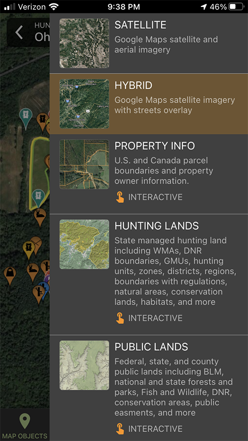
10 - Map Views
Number ten is the many map views available to you in
Huntstand. Choose from Satellite Photos, Vivid Satellite photos, topo maps,
public hunting land maps, street views and more.
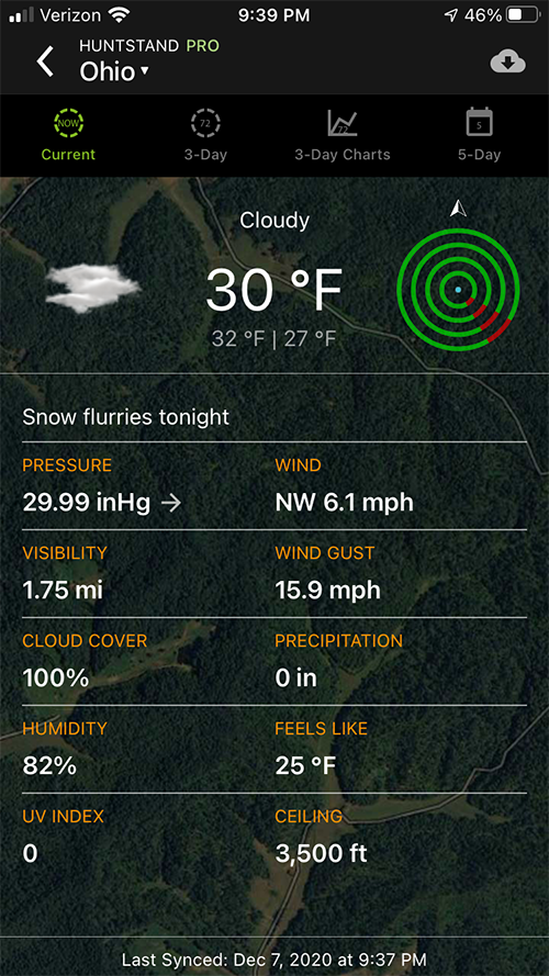
9-Weather Info
Number nine is weather Information. In one screen you see current weather including a wind graphic, a forecast, extensive moon/lunar information, and peak hunting times.
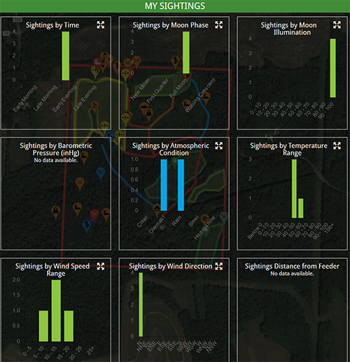
8-Hunt Data
Number eight is hunt data analysis. I'm a data freak, and if you have the time to input things like sightings, trail cam photos, and other info Huntstand will tabulate that data into graphs and charts to help visualize movement and hotspots.
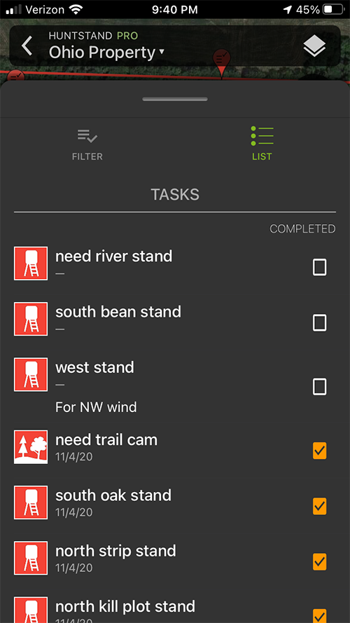
7-Task List
Number seven is task list. So, here's how I use this feature. I am scouting a new area where I find trail crossings, rubs, and scrapes. Then I spot the perfect tree. I simply enter that spot with a task of hang treestand here, put a trailcam there, etc. You can then mark them complete and set the priority.
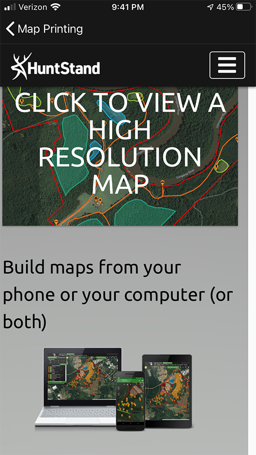
6-Map Printing
Number six is printing maps. Huntstand has a terrific feature where you can print your map, along with all of your icons for treestand locations, crossings and anything you want in your printed photo. With a simple interface you order your map and in a few days it will be at your doorstep ready for framing.
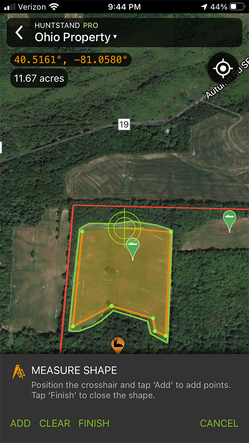
5-Measuring
Number 5 is Measurements. In the old days we had to drive an ATV with a special GPS to get accurate acreage information for planting and fertilizing food plots. With Huntstand I can measure and mark all my plots and distances and those marks will be translated to my app in the field. This is invaluable for land managers.
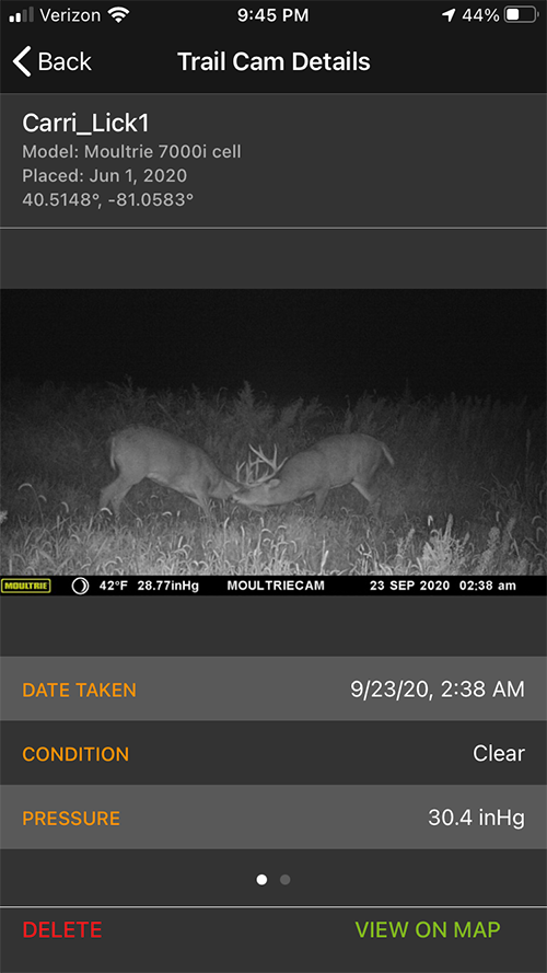
4-Trail Cam Info
Number 4 is trail camera placements and insights. I run 30-40 trail cameras per property. Some of my cams go deep inside a sanctuary and stay there all year. I use Huntstand to mark the exact coordinates of those trail cameras. But that's only one aspect of the trail camera feature. You can add photos received from each trail camera and the metadata from the photo is uploaded into Huntstand so it will show you the time of day, temperature, humidity and camera name. This data can be analyzed to show you what time of day you get most of your mature buck photos. This is a great feature that few know about!
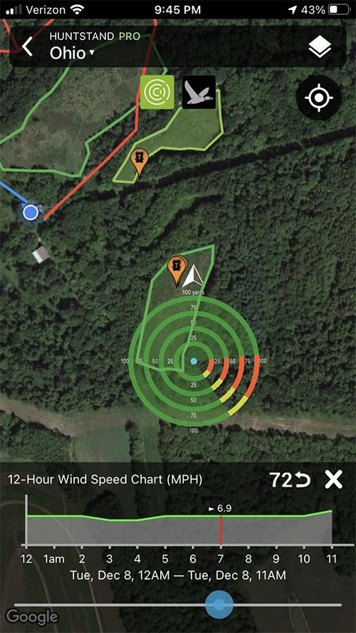
3-Wind Cone
Number 3 is the Wind Cone. For those of you who remember scoutlook, they took that concept and made it better. Now you can instantly see the wind direction, but you can also model the wind over the next few hours, or the next few days. This includes both direction and speed. I use this feature every day during hunting season.
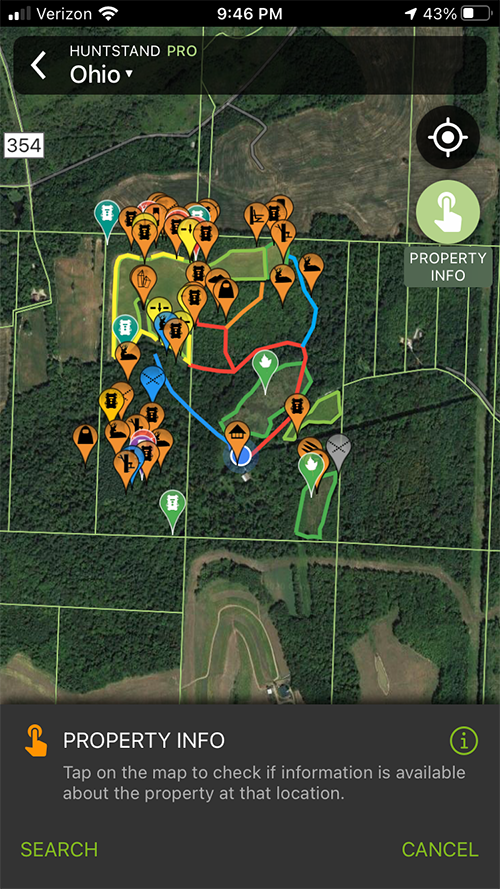
2-Property Info
Number 2 is property information. By choosing the property information baselayer you will know in a glance where boundaries exist. My neighbor hit a buck that crossed into my property. I helped him look until it crossed into the neighbor's property. They were not sure where they were, but my huntstand app gave me the landowner's name which I passed on to the guys tracking the deer. They took it from there.
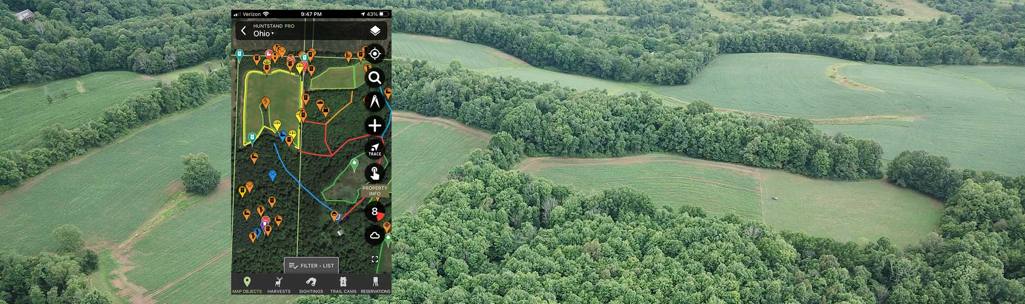
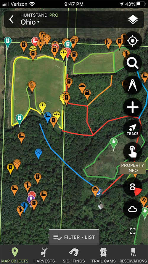
1-App Interface
My Number 1 feature is the mapping interface itself. This allows you to easily items such as treestands, crossings, rubs, scrapes, streams, marshes, treestands, trail cameras, food plots and more. Every item is geo-tagged with exact coordinates and that allows you to plan your hunting strategy carefully when you are back home. These items can be color coded, with descriptions, and even a photo. All the items can be deleted or edited later easily through either the App or the website interface. I have found the huntstand app to be an invaluable tool for scouting, land management, and hunting.