

Hunt Research Tools
Free for onX Hunt Elite Members. Stop dreading application season. onX Hunt Research Tools brings you draw odds, tag trends, harvest statistics, and key pro deals to help you make the most of your upcoming season.
Research. Draw. Hunt.
It’s time to stop dreading application season. Streamline your process and find better opportunities with the help of onX Hunt Research Tools. Our application season tool set is now live, filled with the data and analysis you need to build a better application plan in 2024. This isn’t just draw odds—we’ve added so much more.
We Go Way Beyond Draw Odds
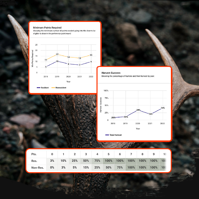
More than just draw odds, Hunt Research Tools also brings you tag trends, harvest stats, hunting pressure info, and more. Utilize individualized draw statistics and points management based on your state of residency and species/state points. FREE with your onX Hunt Elite Membership.

Learn How to Use Hunt Research Tools
Hate Math? Let Us Handle It.
Applying for your dream hunt can seem like an overwhelming process. We’ve designed onX Hunt Research Tools to help make application season as easy as possible—so you can focus on preparing for the hunt after a successful draw.
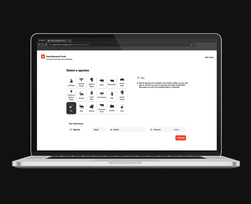
Hunt Research Tools is designed for hunters of all levels, whatever your experience or points status, and uses reliable draw odds data sourced directly from state partnerships. Simple, easy-to-use advanced sorting to help you narrow down thousands of options, allowing you to easily compare your options across states, weapons, species, dates, and hunt types.
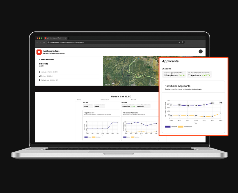
Data-Driven Unit Pages
Hunt Research Tools Unit pages allow you to deep dive into the data, gaining an accurate picture of unit health through trending tag quotas, applicant numbers, harvest data, and more.
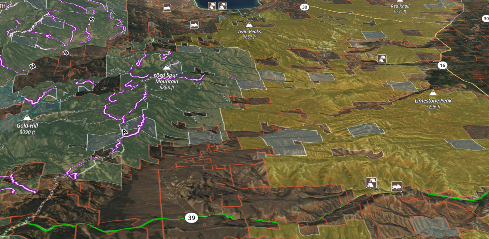
Experience Draw Data + Map Tools
Access unit-specific data and comparisons with an intuitive, user-friendly interface. Our 2D/3D Hybrid Maps show you public / private land boundaries and more, and integrates on your desktop computer for in-depth unit terrain analysis.